Aerial Mapping
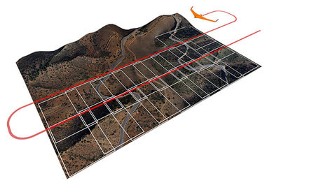
Map and survey large areas in one flight
Map and survey large areas in one flight
We provide aerial mapping services using our fixed wing drone covering all types of land, including agricultural, farming, mining, construction and environmental areas.
Our services include:
Our services include:
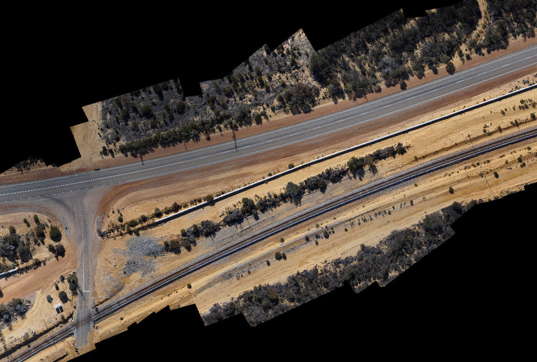
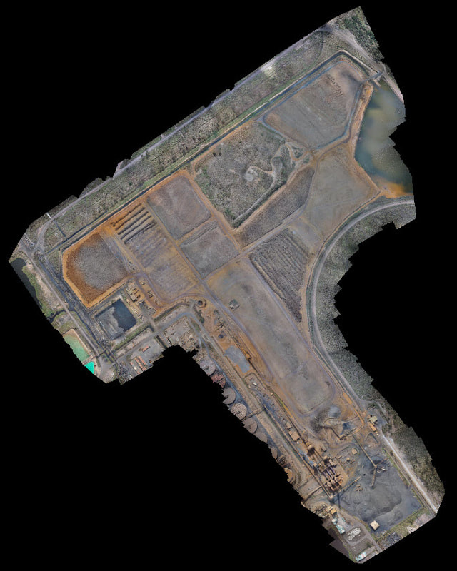
- Fully geo-referenced maps and images
- Marking of specific assets, areas and points of interest
- High resolution images of specific areas down to 1cm/pixel
- 3D Land surveys
- Topographic maps
- Contour and elevation modeling
- Creating maps ready to overlay onto Google Earth or other farm mapping program such as Phoenix
- Exporting map data in many formats ready to upload into your preferred GIS software.
- Digital Surface Models
- Point Clouds
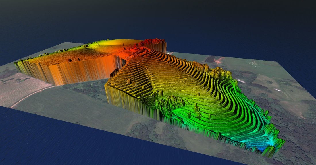
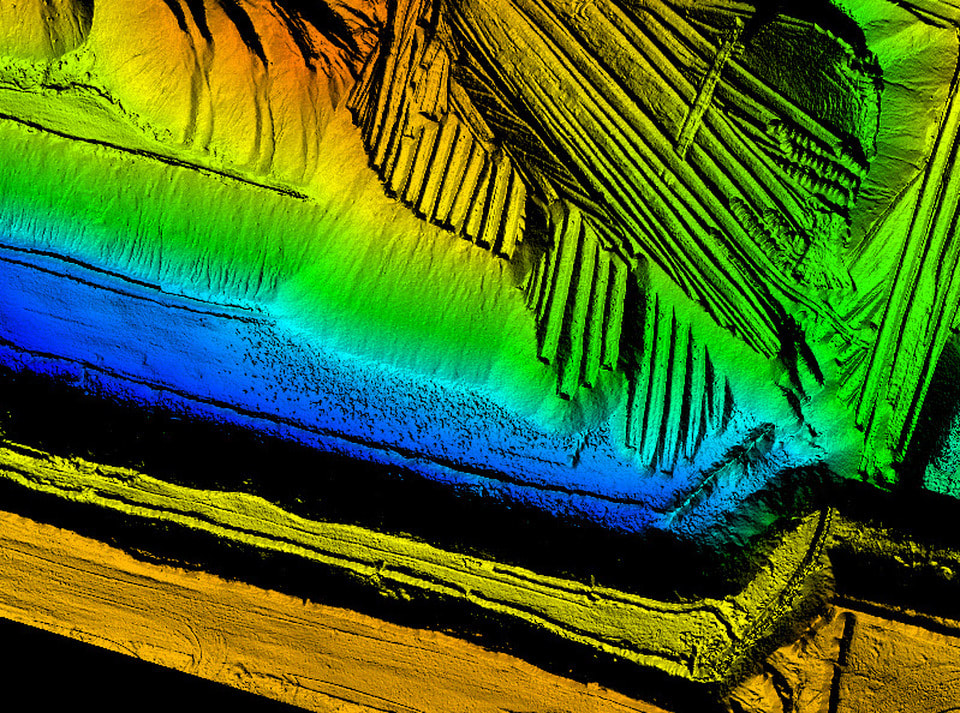
3D Mapping
We provide 3D point cloud mapping services using our UAV (drone) covering all types of land, including agricultural, farming, mining, construction and environmental areas.
Our services include:
Our services include:
- Generation of 3D point clouds
- Terrain and Contour Maps
What is a point cloud? - A point cloud is a 3D model made up of millions 3D points. This allows visualisation of the 3D model as well as calculations to be made from the model. The point cloud can be used for many purposes but they are commonly used to calculate heights, distances, slope angles and volumes for earth works and for watershed management.
Watch the videos below to go for a "fly through" of a 3D point cloud.
Watch the videos below to go for a "fly through" of a 3D point cloud.
© 2013-2023 Aerial Image Works Pty Ltd